
Margett’s Pit
Client: Land Remediation & Restoration Contractor
Location: Kent, UK
Project Scope: Annual Cut and Fill Analysis for Quarry Restoration
The Objective:
The Challenge:
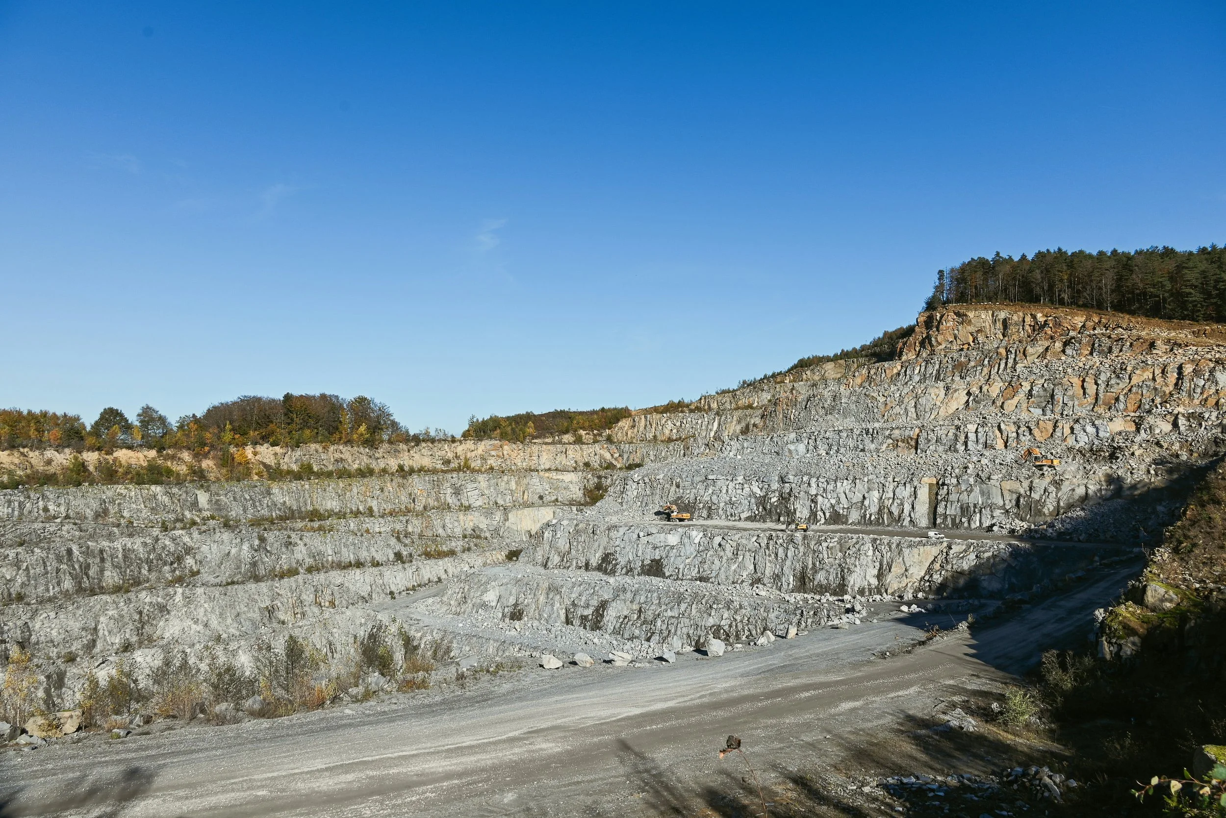
Our client manages a major restoration project in North Kent, where a former quarry is being repurposed. This involves a complex cut-and-fill operation: moving existing material from high points on-site (the "cut") to fill the deep quarry voids (the "fill").
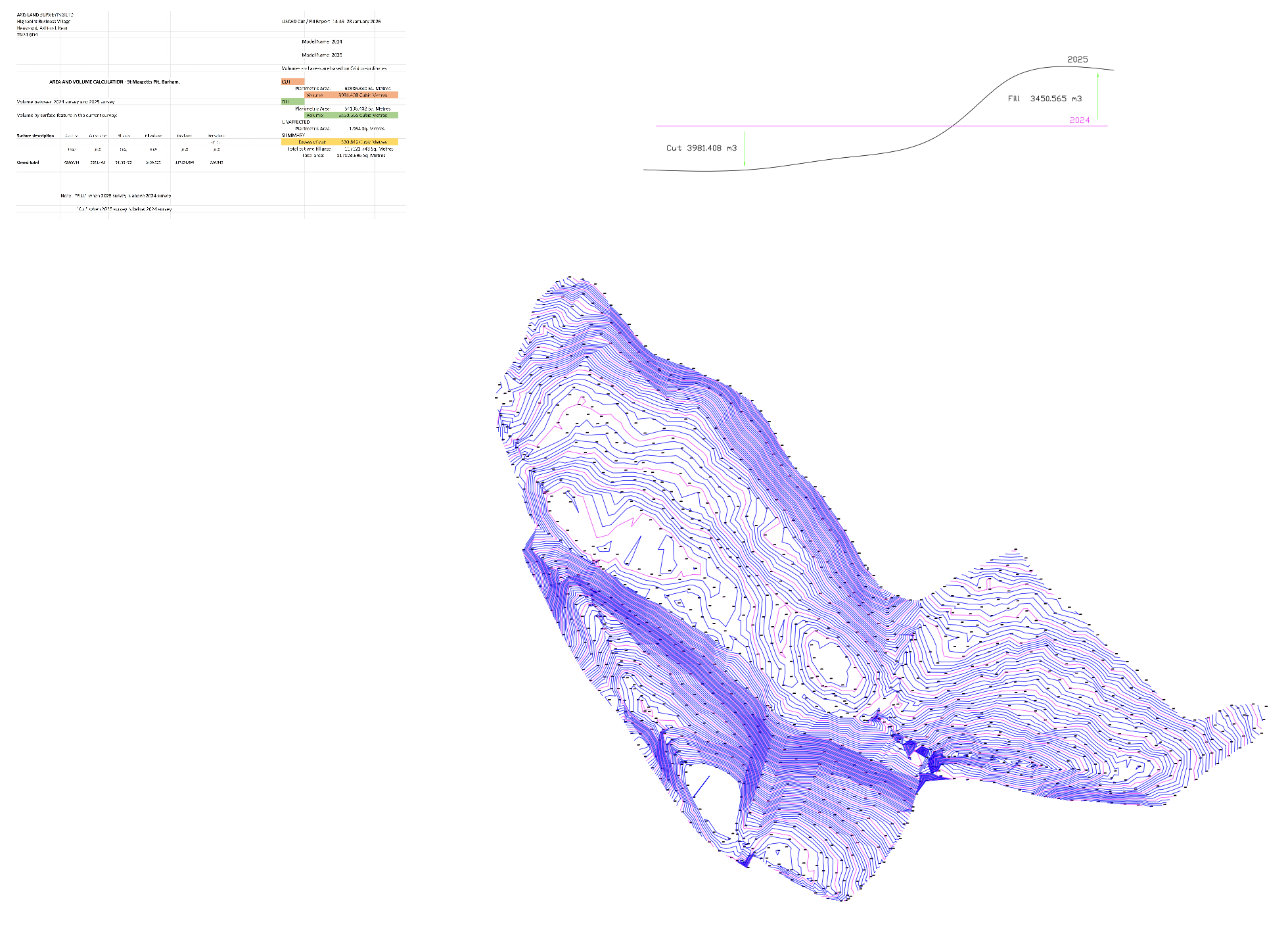
The goal of our annual survey is to provide a precise balance sheet of these earthworks. The client needs to know exactly how much earth has been moved and where it has been placed to ensure the final landform matches the approved architectural masterplan.
Managing earthworks on this scale requires more than just a general idea of progress. The client faced several hurdles:
Balancing Volumes: To keep costs down, the client aims to use only the material available on-site. Knowing the exact "cut" potential versus the remaining "fill" requirement is critical.
Complex Topography: The rugged nature of a quarry makes manual measurement inaccurate. Without precise data, it is easy to over-excavate or under-fill.
Health and Safety: With heavy plant machinery—such as dozers and scrapers—constantly reshaping the terrain, we needed a way to survey the site without puting staff in the path of moving vehicles.
Our Approach:
Outcome:
We utilized high-precision Laser Scanning to capture a complete 3D digital model of the entire site.
3D Surface Mapping: By scanning the site from elevated, safe positions, we created a highly detailed "snapshot" of the current ground levels.
Volume Comparison: We used specialized software to overlay this year's surface against the previous year’s survey. This allows us to see exactly where the ground has been lowered (cut) and where it has been raised (filled).
Design Verification: We also compared the current levels against the "final finished levels" required by the planning permission to show exactly how much work is left to reach the goal.
Precision Earthworks Management: Our report provided the client with the exact volume of material moved, allowing them to verify the efficiency of their heavy machinery and contractors.
Site Restoration Accuracy: We identified specific areas where the fill was approaching the design limit, preventing costly over-filling and ensuring compliance with local planning height restrictions.
Safety & Minimal Disruption: Because our scanners work from a distance, the quarry team didn't have to pause their work. We captured all the necessary data while the dozers continued their operations safely.
Future Forecasting: With the data provided, the site manager can now calculate how many months of work remain based on their current rate of progress